
 Sudan Map showing 5 states
Most of Sudan's topography is consisted of deserts, except for the narrow strip of the Nile valley which helped provide fertile agriculture and abundant pastures. Because of the availability of food and fresh water, the Nile Valley was populated more so than any other region in Sudan. The first civilization in Sudan, and one of the first in the world, developed there, along the Nile Valley.
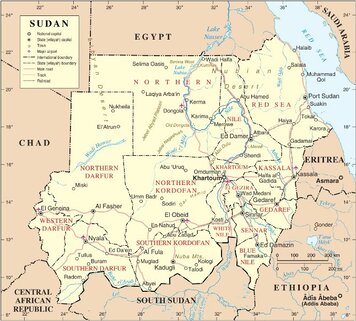
18 states form the territory of the Republic of Sudan. We will be covering 5 of the main states.
These states are Blue Nile, Kassala, Khartoum, North Kordofan & Red Sea.
Below is map of their location in Sudan.
|
|
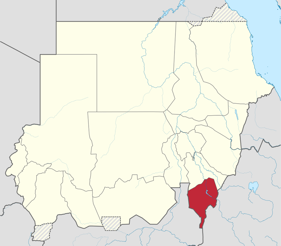


BLUE NILE STATE
|
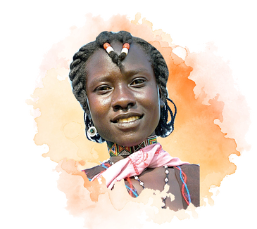
Blue Nile Girl
|

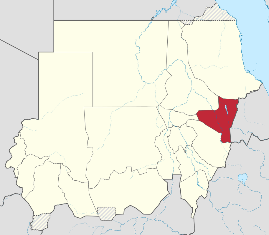
KASSALA STATE
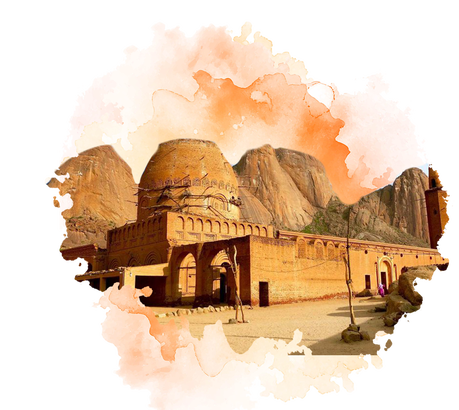 Old mosque at Taka Mountain, Kassala
- Kassala is the capital of the state; other towns in Kassala include Aroma, Hamashkoraib, Halfa el Jadida (New Halfa), Khashm el Girba and Telkuk
- Kassala (City) is built on the banks of the Gash River, it is a market town and is famous for its fruit gardens
- The Mareb River (or Gash River), is a river flowing out of central Eritrea.
- Its headwaters rise south-west of Asmara in central Eritrea. It flows south, bordering Ethiopia, then west through western Eritrea to reach the Sudanese plains near Kassala.
- Many of its inhabitants are from the Beni-Amer group, with others being of Hadendawa, Tigre, and Bilen origin in addition to a small group of Rashaida nomads who migrated from Eritrea in the last three decades.
- Kassala is famous for its coffee, which is traditionally served in a clay coffee pot (jabana).

KHARTOUM STATE
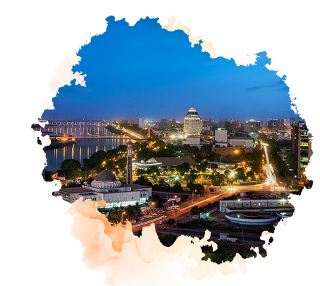 View of City of Khartoum
- It is the smallest state by area (22,142 km2), but the most populous (5,274,321 in 2008 census)
- First established in 1821, as a military outpost for the Egyptian Army, Khartoum said to have derived its name from the thin spit of land at the convergence of the Nile rivers, which resembles an elephant's trunk or khurtum.
- Cities with Khartoum: Khartoum (Capital), Omdurman, Bahri, Sharq an-Nīl, Jabal, Awliya, Om Badda, Karari.
- Khartoum located in the heart of Sudan is where the White Nile and the Blue Nile unite to form the Nile River. As they join, each river retains its own color: the White Nile with its bright whiteness and the Blue Nile with its brown color.
- Divided by the two rivers, Khartoum is a tripartite metropolis- meaning it is divided into 3 densely populated urban areas.
- People throughout the state of Khartoum wear toubs and jalabiyas. However for work and other affairs men tend to wear button-down shirts and long trousers, while women wear long shirts and shirts.
- Central Sudan, is perhaps the region that is the most diversified and colorful in its cuisine and dietary habits. This is due to its being a melting pot for the different Sudanese cultures and peoples, and to its exposure to external influences.
- More resources about Khartoum https://en.wikipedia.org/wiki/Khartoum
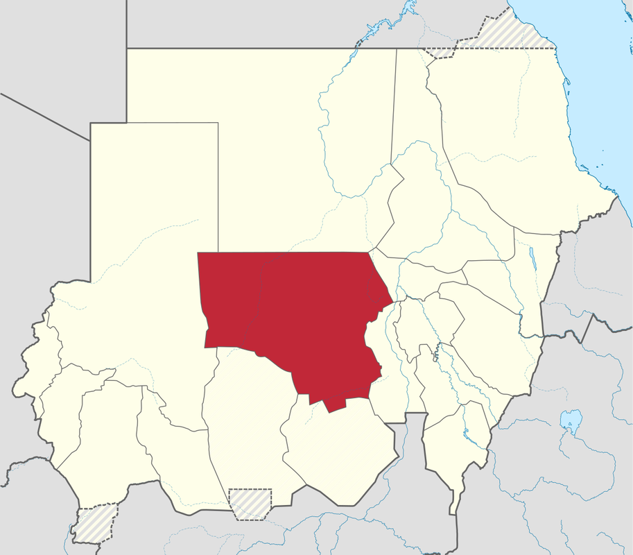
NORTH KORDOFAN
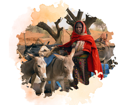 Kordofan Girl
- Cities in North Kordofan: Al-Ubayyid (capital), Al-Nuhud, Er Rahad, Umm Ruwaba, Bara, Gibaish, Sodari, Abu Zabad, Umm Dam.
- Al-Ubayyid an important transportation hub: the ending point of a rail line, the junction of various roads and camel caravan routes, and the end of a pilgrim route from Nigeria.
- The weather is generally dry and arid.
- For centuries, North Kordofan was inhabited by nomads and pastoralists, mainly the Dar Hamid, Dar Hamar, Guamaa, Kababish, Bideriya, Shwehat and including the Yazeed tribes.
- Severe water shortages restrict crop production in the northern part of Kordofan. Some cereal grains and other food crops are grown, but the arid land is more suited to raising camels, sheep, and goats.
- Resources about North Kordofan https://en.wikipedia.org/wiki/North_Kordofan
RED SEA STATE
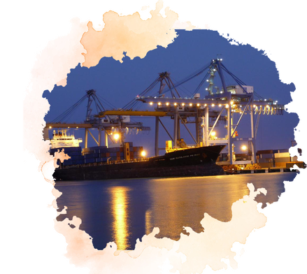 Port Sudan - Red Sea
- The Red Sea state is divided into the eight administrative areas: Bur Sudan (Port Sudan), Gebiet Elma'din, Halayib, Haya, Sawakin, Sinkat, Gunob Awlieb, Derodieb, Tokar and Ageeg.
- Port Sudan is the Capital.
- The original inhabitants of this State are the Beja people; they make up above 65% of the current population with lower wealth and power.
- It was built in 1905 and handles the majority of the country's international trade. Major exports include oilseed, senna, and hides and skins. Imports include construction materials, heavy machinery, and vehicles.
- Those living along the desert tend to cover their faces from the hot gusts of sand,
- Those living in Port Sudan wear loose clothing and spend a lot of their time in the markets.
Check out this video about Sudan Red Sea and for more info about Red Sea State, please visit https://en.wikipedia.org/wiki/Red_Sea_(state)

Copyright 2019 © My Sudan. All Rights Reserved.
